Atlas of Switzerland

Open access
Datum
2019-07-15Typ
- Report
ETH Bibliographie
yes
Altmetrics
Abstract
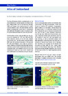
The Atlas of Switzerland (AoS) is mandated by law by the Swiss Federation to visualise spatially distributed topics from different fields, such as Socio-Economy, Ecology, Traffic, and Energy, in an ongoing long-term project. Since its creation in 1961, the Swiss National Atlas has offered cartograp Mehr anzeigen
Persistenter Link
https://doi.org/10.3929/ethz-b-000371965Publikationsstatus
publishedHerausgeber(in)
Buchtitel
National Report - Cartography in Switzerland 2015-2019Zeitschrift / Serie
Cartographic Publication SeriesBand
Seiten / Artikelnummer
Verlag
Swiss Society of CartographyThema
Atlas of SwitzerlandOrganisationseinheit
03466 - Hurni, Lorenz / Hurni, Lorenz
Zugehörige Publikationen und Daten
Is part of: https://doi.org/10.3929/ethz-b-000350168
ETH Bibliographie
yes
Altmetrics