TopoZeko: A MATLAB function for 3-D and 4-D topographical visualization in geosciences

Open access


Author
Date
2017-11-23Type
- Journal Article
ETH Bibliography
yes
Altmetrics
Abstract
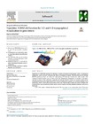
TopoZeko is a MATLAB function for plotting a variety of natural environments with a pronounced topography, such as glaciers, volcanoes and lakes in mountainous regions. This function extends existing MATLAB plotting routines and allows for high-quality 3-D landscape visualization, with a single col Show more
Permanent link
https://doi.org/10.3929/ethz-b-000226658Publication status
publishedExternal links
Journal / series
SoftwareXVolume
Pages / Article No.
Publisher
ElsevierSubject
MATLAB function; Visualization tool; 4D visualization; TopographyOrganisational unit
09599 - Farinotti, Daniel / Farinotti, Daniel
More
Show all metadata
ETH Bibliography
yes
Altmetrics